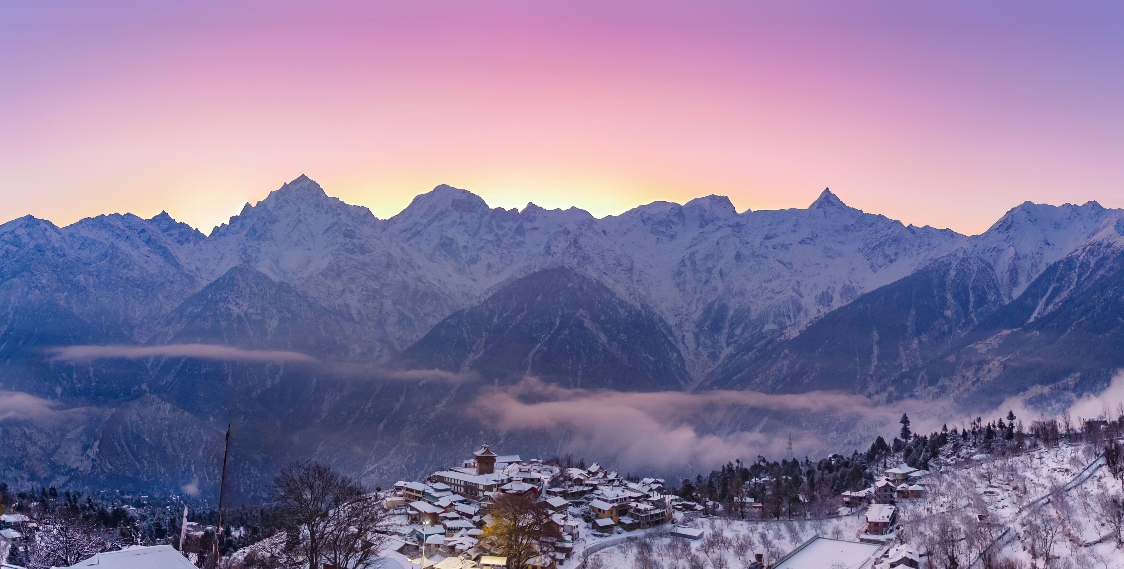
The Kinner Kailash range in Kinnaur district, Himachal Pradesh

Kinnaur / Himachal Pradesh

KINNAUR

Scroll

Kinner Kailash range, Kinnaur · Anubhav Agarwal; derivative work by UnpetitproleX · CC BY-SA 4.0

01 / Roots

Before Kinnaur was a destination, it was a place shaped by mountains, people and generations of cultural life.

This record keeps only what the official district record of Kinnaur, Government of Himachal Pradesh, sets down. Where that record says the past is obscure, this archive says so too.

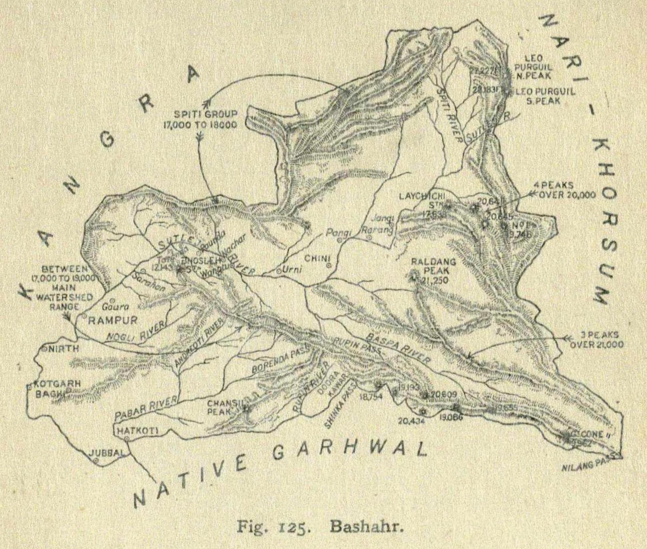
Map of Bushahr State, Punjab Province, British India, published 1916
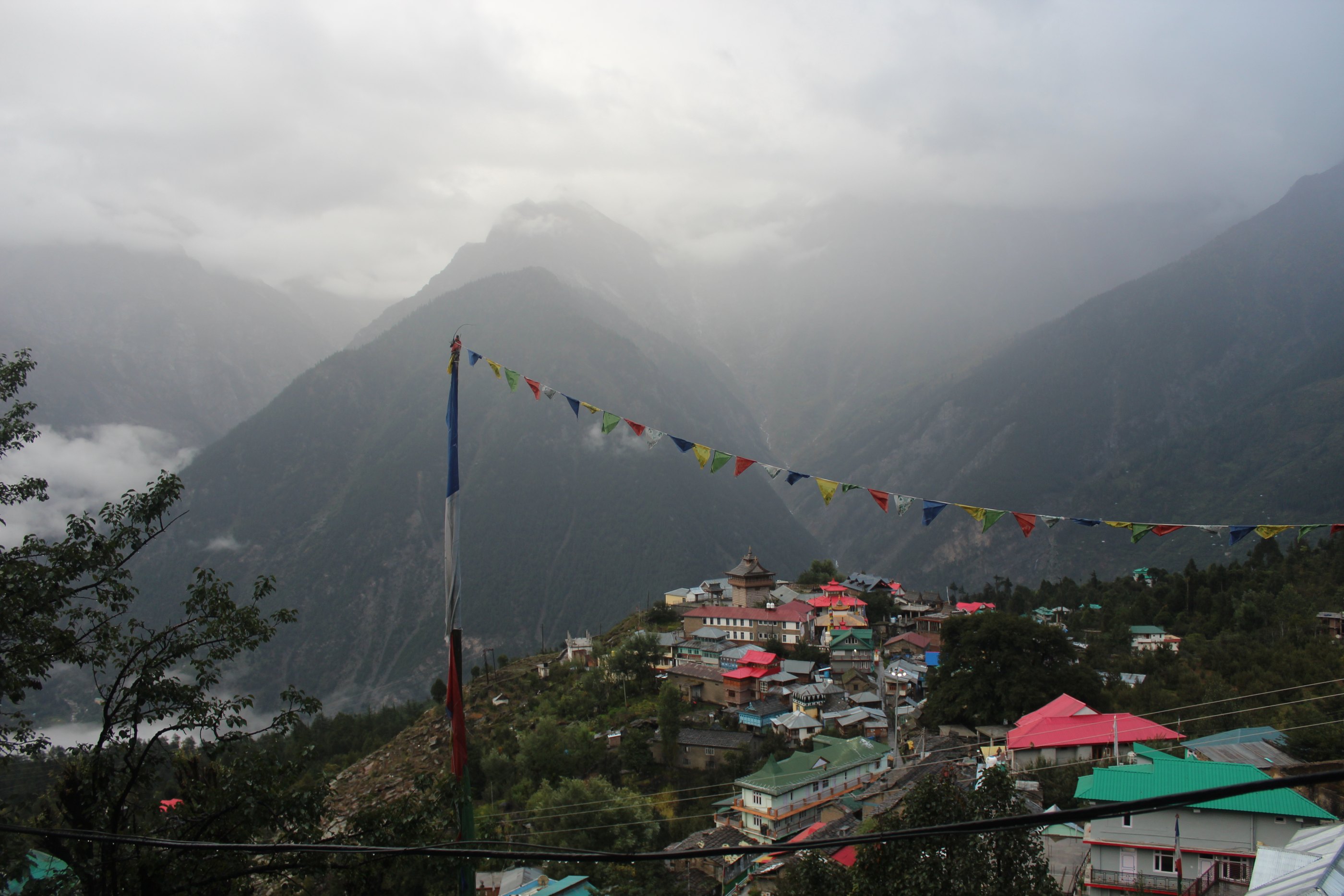
Chini village and Kila at Kalpa, Kinnaur district

02 / Then → Now

0%

Archival document

Photograph

Map of Bushahr State, 1916

Published in 'The Panjab, North-West Frontier Province and Kashmir' (1916) · Public domain · Wikimedia Commons

Kinnaur was part of the erstwhile Bushahr State, with its headquarters at Rampur, until the merger of the state on the eve of independence. The same valleys carry the district today.

03 / History

Six moments that the record can hold.

Nothing has been added to lengthen this sequence. Each entry below restates what the district record sets down, and the first entry states its own limits.

Early history

Record uncertain

An obscure record

The official district record states that in the absence of authentic historical record the early history of the Kinnaur region is obscure, and that references to the Kinnaura or Kannaura and their land are by and large confined to legends and mythological accounts.
Before the 14th century

Documented history

Thakurs, and the founding of Bushahr

The record notes that the area between the Satluj, its tributaries and the Baspa was under the rule of Thakurs from very early times, known by the places they held — Chini Thakur, Kamru Thakur. The Thakur of Kamru proved the strongest, annexed the other territories, and laid the foundation of the state of Bushahr, to which the region of Kinnaur belonged until the dissolution of the state.

By the 14th century

Documented history

Sat khund — seven parts

By the beginning of the fourteenth century the entire area of Kinnaur was divided into seven parts, locally called sat khund, splitting further into many small hegemonies. Forts at Labrang, Morang and Kamru are cited as remains of that age.

1803 – 1815

Documented history

The Gurkha invasions

Citing the Punjab States Gazetteer — Shimla Hill States, the record describes Bushahr facing Gurkha invasions from 1803 to 1815. The treasury at Sarahan was looted and the records of the state destroyed. Amar Singh Thapa was defeated on 15 April 1815, and Raja Mahendra Singh was granted a sanad on 6 November 1815.

1891

Documented history

Chini tehsil

Chini tehsil, covering the entire Kinnaur valley beyond Wangtu, was created in 1891 by the then ruler Tika Raghunath Singh, and continued in existence until 1960. From 1947 it was a tehsil of the then Mahasu district.

1 May 1960

Documented history

Kinnaur becomes a district

In view of ethnic and cultural considerations, the areas of Chini tehsil together with areas that lay partly in Rampur tehsil were reorganised into a separate district. Kinnaur came into being as an independent district with effect from 1 May 1960.

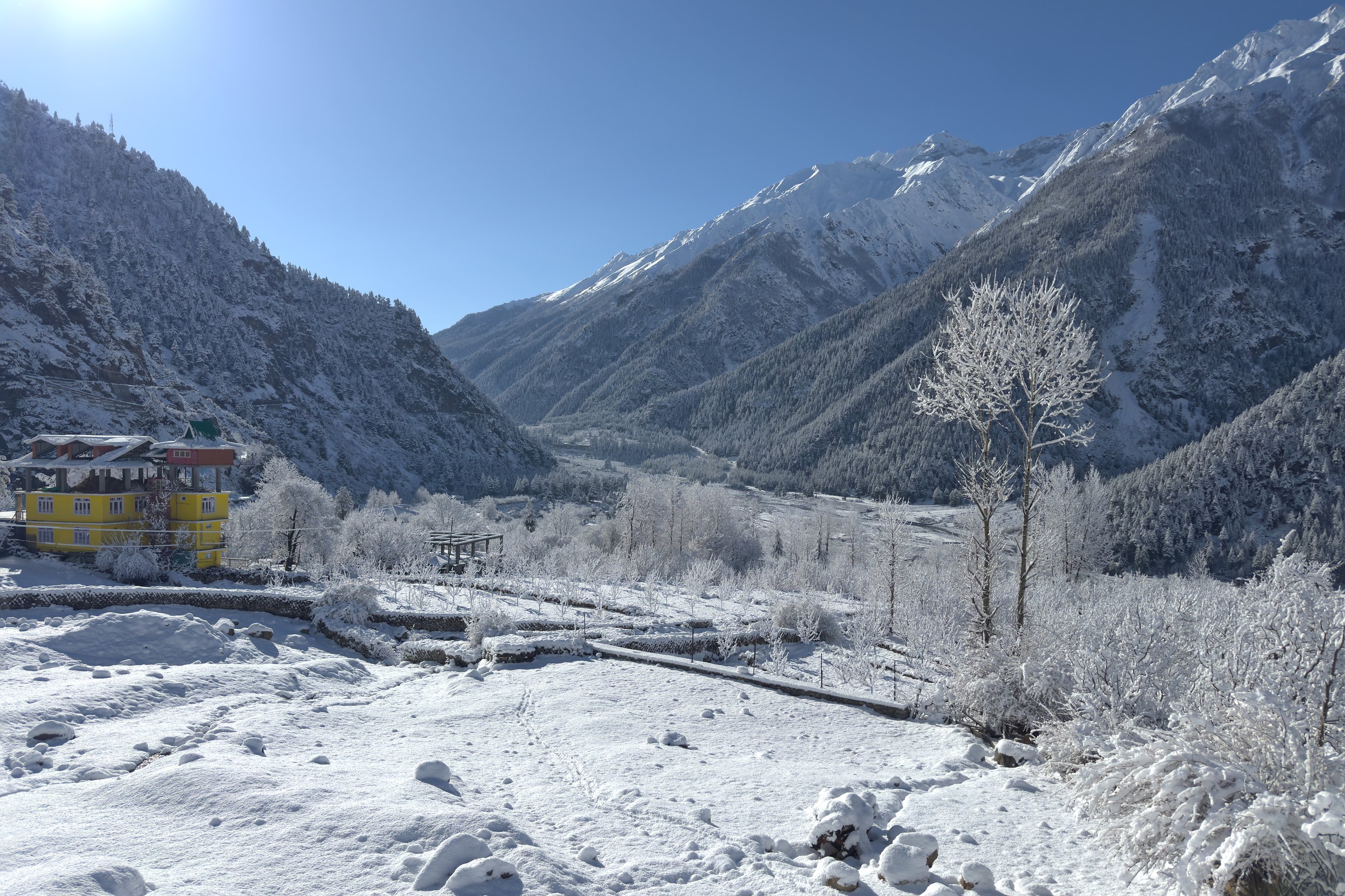
The Baspa valley at Sangla, Kinnaur district

04 / Land

The valleys carry the district.

Kinnaur lies in the north-eastern corner of Himachal Pradesh and is bounded by Tibet in the east. The Satluj is the main river; the Spiti and the Baspa are among its tributaries.

Photograph/Baspa valley, Sangla/17 March 2025
UnpetitproleX · CC BY-SA 4.0 · Wikimedia Commons · 7918 × 5278 original

05 / People

Not one group, but three territorial units.

The district record states plainly that present-day Kinnauras do not constitute a homogenous group, and displays significant territorial and ethnic diversity. For understanding that distribution, the record divides the district in three.

Lower Kinnaur

Between Chora, at the district boundary with Rampur Bushahr, and Kalpa — including the Nichar and Sangla valleys.

The record describes the people as primarily of Mediterranean physical type, with affinity to the adjoining Shimla district; mostly Hindu, though ethno-historical factors have resulted in some Buddhist influence.

Middle Kinnaur

Between Kalpa and Kanam, including Moorang tehsil.

Described as of mixed strain — some with marked Mongoloid and others marked Mediterranean features. Inhabitants are Buddhist as well as Hindu, and many people have faith in both religions.

Upper Kinnaur

The remaining north-eastern part of the district — between Pooh and the Hangrang valley, extending to the international border with Tibet.

The predominant physical type is described as Mongoloid, with a few persons of Mediterranean features around Pooh.

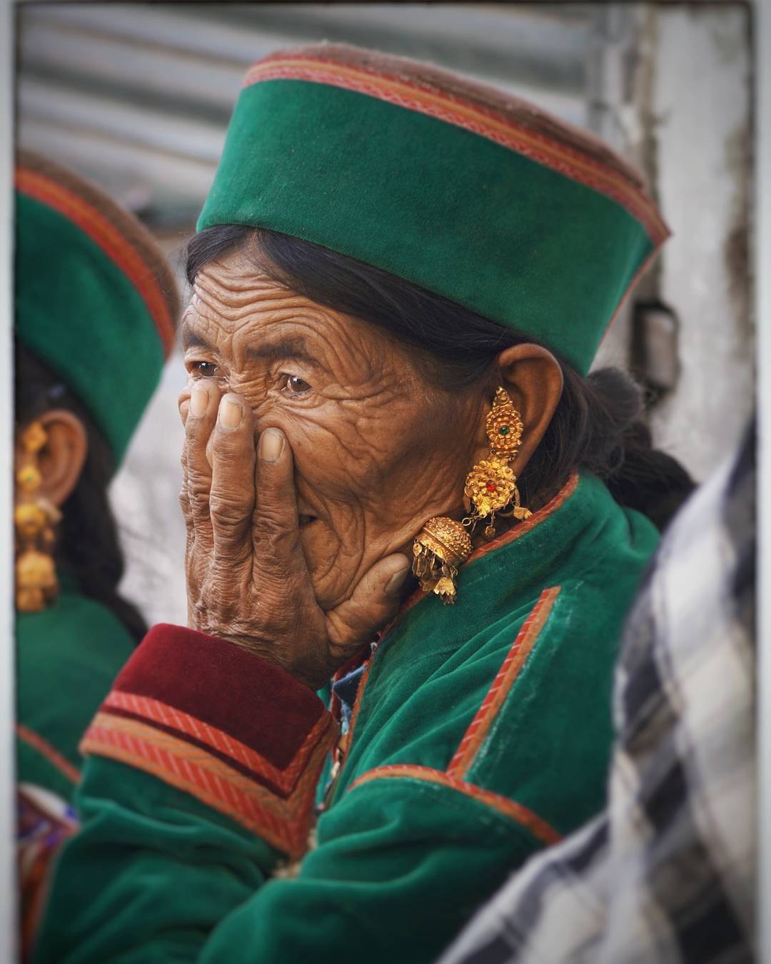
A woman in Kinnauri dress, with the woollen cap worn in the district
Photograph/Kinnaur/10 August 2017
Lokesh Negi · CC BY-SA 4.0 · Wikimedia Commons · 1080 × 1351 original — shown small; awaiting a higher-resolution replacement

06 / Dress

Wool, suited to the climate.

The head dress of men and women is a round woollen cap called thepang in the local dialect, generally light grey or white with a coloured band. Men wear a tailored woollen shirt, the chamn kurti, and woollen churidar pyjama; the chhuba is a long woollen coat somewhat resembling an achkan, worn with a sleeveless woollen jacket.

Women wrap a woollen garment called dohru, its first wrap on the back, the embroidered border running its length to the heels; darker shades are preferred. A choli, a full-sleeved blouse, is also worn.

The record notes that traditional footwear made of wool and goat hair with a goat-hide sole has almost disappeared, and that cotton and synthetic salwar-kameez, pants and shirts have become popular among younger Kinnauras.

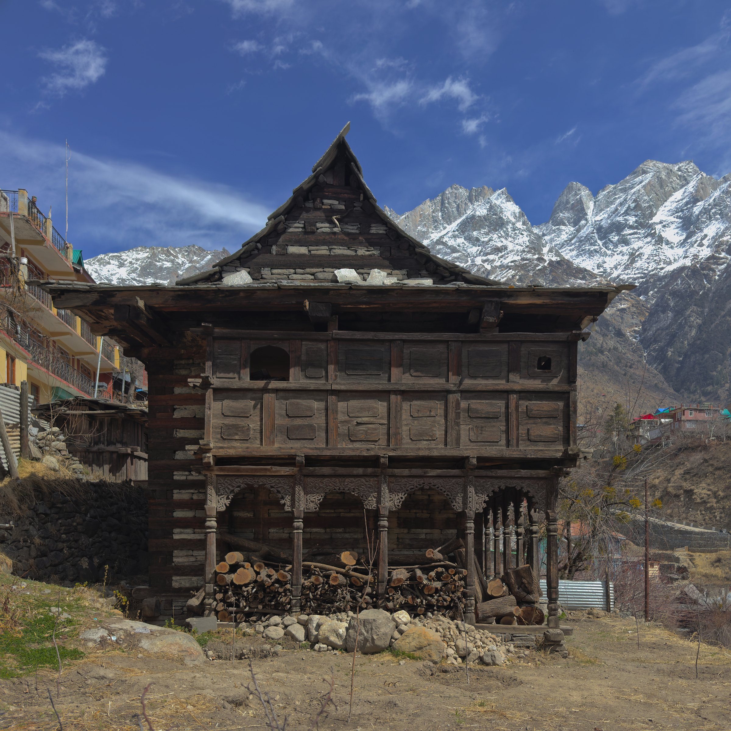
A traditional Kinnauri house of stone and wood at Sangla

07 / Houses & architecture

Stone below, wood above; the pattern changes with the valley.

In lower Kinnaur houses are two-storeyed and built of stone and wood, with slated roofs or flat roofs of layered bhojpatra bark covered with earth; doors often fold and open inwards.

In upper Kinnaur houses are usually of stone, flat-roofed and earth-covered, with small doors, the ground floor used as a cattle shed and the upper storey for living. Houses are whitewashed in both. RCC houses in modern designs are now also coming up.

Photograph/Traditional house, Sangla/14 March 2025
UnpetitproleX · CC BY-SA 4.0 · Wikimedia Commons · 5759 × 5759 original
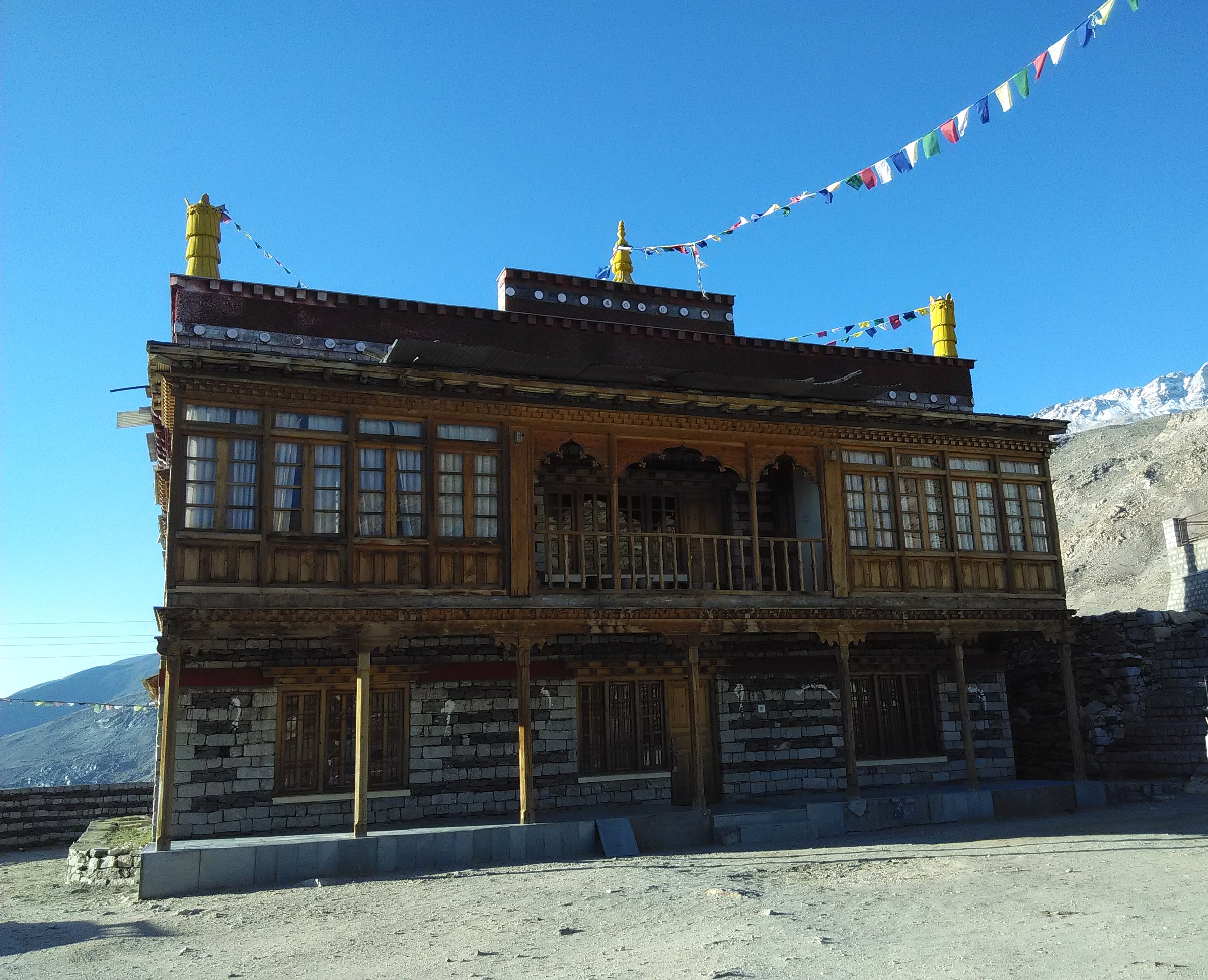
Monastery building at Nako, Kinnaur district

08 / Religion & belief

No single religious identity.

Lower Kinnaur is mostly Hindu with some Buddhist influence; middle Kinnaur is both Buddhist and Hindu, and the record notes that many people have faith in both; upper Kinnaur is mostly Buddhist, with a monastery in almost every village.

Photograph/Monastery at Nako/28 June 2015
Sumita Roy Dutta · CC BY-SA 4.0 · Wikimedia Commons · 2944 × 2388 original

08 / Religion & belief — the record

Documented history

Deities named in the record for lower Kinnaur include Durga or Chandi, Bhairon, Usha or Ukha, Narayan, Vishnu, Badrinath and Bhimakali; the record adds that each village has its presiding deity.

For middle Kinnaur it names Chandi, Gauri Shankar, Kansa and Narayanjee, and notes monasteries besides temples.

Lamas and jomos are described as recruited from among the Kanet; the two principal nunneries named are at Kanam and Sunnam.

Tradition / belief

The record states that the village god at Kanam worshipped by people of Buddhist faith is Dabla, who has certain features associated with the earlier Bon religion, and that the image of Dabla is installed alongside those of Buddha and Guru Rinpoche (Padma Sambhava) in one of the monasteries at Kanam.

Beyond this, accounts of Kinnaur's earliest past are, in the district record's own words, largely confined to legends and mythological accounts. They are not presented here as history.
09 / Language

A number of dialects, not one uniform speech.

The dialects spoken in the district come under 'Kinnauri' or 'Kanauri'. In the classification of the Linguistic Survey of India, 'Kanauri' falls under the Tibeto-Chinese family, in the Western sub-group of the Pronominalized Himalayan group. The record counts as many as nine different dialects used by various sections of the district.

  • Tibetan dialects of western Tibet

    Nesang, Kunu and Charang, adjoining Tibet

  • Jangram

    Jangi, Lippa and Asrang, Moorang tehsil

  • Shumcho

    Kanam, Labrang, Spilo, Shyaso and Rushkalang, Pooh tehsil

  • Kinnauri–Jangram mixture

    Rakchham and Chhitkul, Sangla tehsil

10 / Food

What the ground gives.

The staple food is wheat, ogla, phafra and barley, all local produce; kankani, cheena, maize, chollair and bathu are also taken. Principal pulses are peas, black peas, mash and rajmash. Rice is relished, imported from the plains.

A salted tea called cha, taken morning and evening, is popular, usually with sattu of parched barley flour. Alcohol is distilled at household level from locally grown fruit — grapes, apple, pear — and from barley.

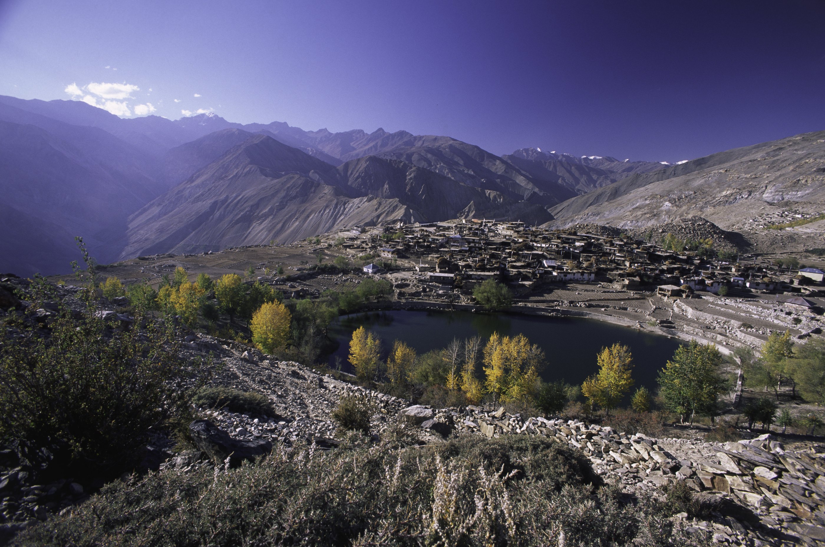
Nako lake and Nako village in upper Kinnaur

11 / Upper Kinnaur

Between Pooh and Hangrang, to the Tibet border.

The record places upper Kinnaur in the remaining north-eastern part of the district, extending to the international border with Tibet.

Photograph/Nako lake and village, Hangrang/10 October 1999
Snotch · CC BY 2.0 · Wikimedia Commons · 7387 × 4900 original

12 / Oral memory

An empty shelf, kept open.

The district record states that the Kannauras are very fond of music, dance and singing. No verified recordings of voices, songs or spoken language were available to this archive, so none are presented. The four shelves below are the framework only, awaiting recordings that can be sourced and credited.

Voices

No verified recording held. Reserved for future documented material.

Songs

No verified recording held. Reserved for future documented material.

Stories

No verified recording held. Reserved for future documented material.

Language

No verified recording held. Reserved for future documented material.

13 / Kinnaur today

Documented change, not a verdict on it.

The district record notes changes it observes directly: RCC houses in modern designs coming up beside traditional stone-and-wood houses; china crockery and stainless steel replacing brass and bronze utensils; readymade shoes in place of indigenous ones; salwar-kameez, pants and shirts popular among younger Kinnauras.

These are the changes the record sets down. This archive makes no claim about what they mean.

District headquarters
Reckong Peo
Constituted
1 May 1960
Formerly
Chini tehsil, Mahasu district
Earlier still
Bushahr State, headquarters at Rampur
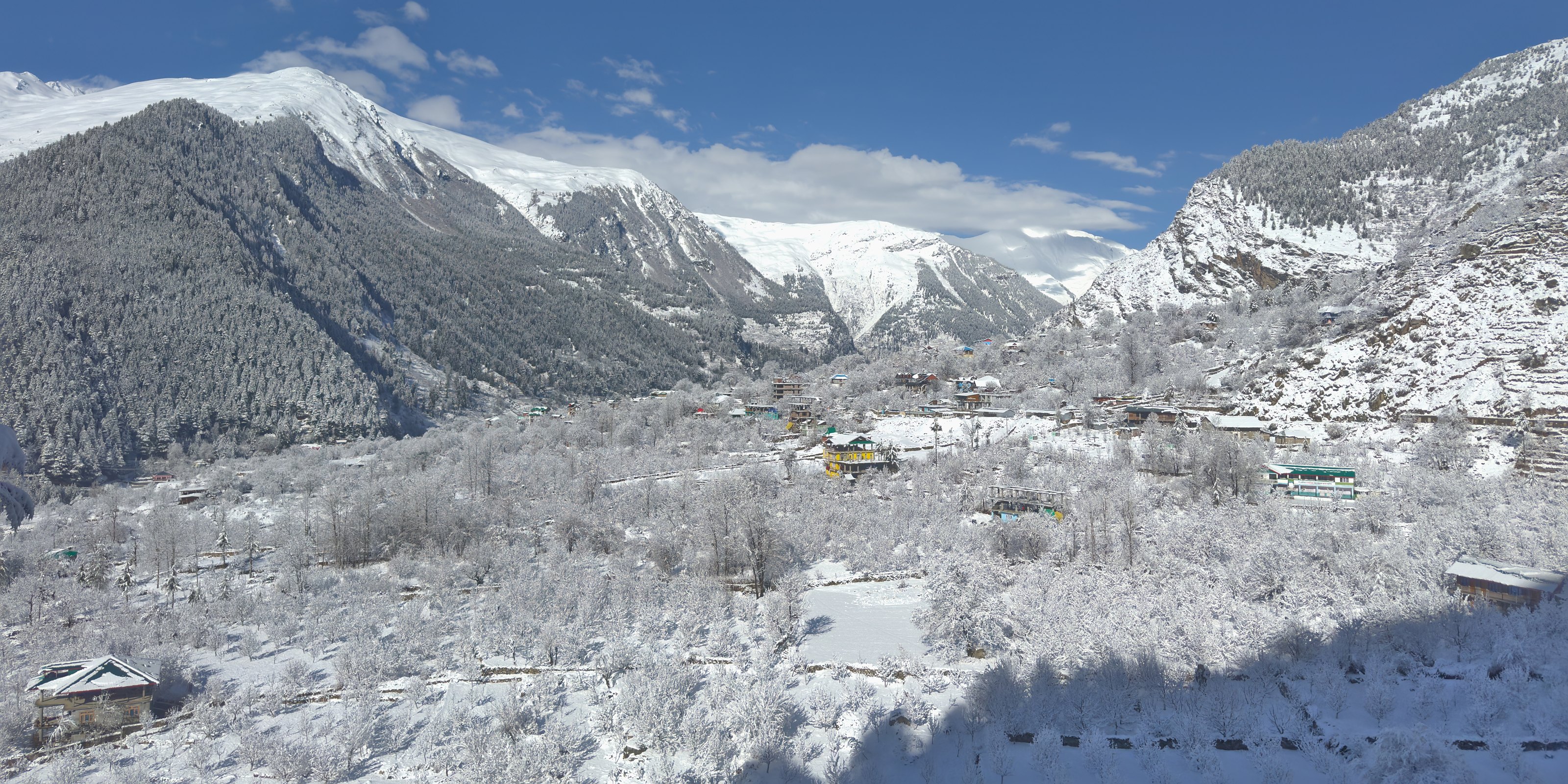
Snowy morning at Sangla, Kinnaur district

KINNAUR

A living record of people, place and memory.